|
Whiteshield Camp
(first rough draft)
Whiteshield
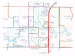
Camp was located one mile north of Hammon. The original Whiteshield Camp
was located around the bend of the Washita River toward the northeast and
was occupied from the about 1890 to 1934. The map below is shows of the
location of both the old camp and new camp. The new camp is in the
bottom center of the diagram. The old camp is around the bend of the
river to the northeast.
(click
on the thumbnail to see a larger view)

The
Washita flood of 1934 washed the old Whiteshield camp completely away.
The old camp had permanent houses. The houses were small wood frame
buildings that were constructed by the government. The decaying shell of
one of the original houses from the old camp is standing today.
(click
on the thumbnails to see larger views)
After
the Washita flood of 1934, the residents of the Whiteshield camp moved to
higher ground near the bend of the river about a half mile southwest of
the old camp. The four photographs below show the type houses that existed
in the new camp. The dwellings were constructed of tents, thatch
houses and simple one-room wooden buildings.
(click on the thumbnails below to view larger photos.)
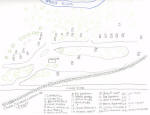
The
map below is a first rough draft of the Whiteshield Camp as it existed in
1952. The camp began to be vacated in the early 1960's. By the
mid-1960's everyone had moved into Hammon.
(click
on the thumbnail to see a larger view)

|